Back in September it was decided by me and my siblings that our dear mother had to go into a care home after a series of falls and a diagnosis of Covid Syndrome. This necessitated a home clearance job for us all, organised by our able sister who promptly disappeared off to the Ionian on a sailing holiday – a trip she and her crew had been having palpitations about all summer!
So, far from the sea on a prolonged visit to deepest Devizes, during many discussions on messenger our mother’s possessions were ‘split’ between us. I was ably assisted by my good mate in working through ‘sister’s job list’ … it also fell to my lot to ‘sign’ mother into her new home too…
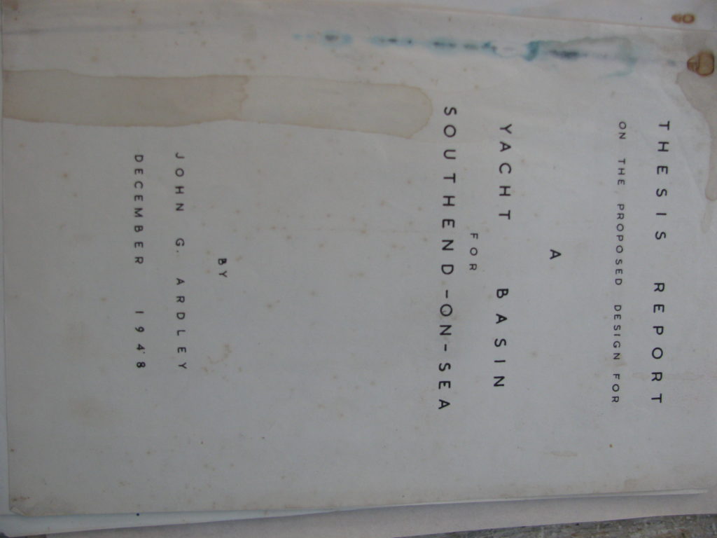
While clearing a desk, I came across our father’s architectural thesis dated 1948. I ‘lifted’ this as something of interest to delve into later. It being about the area I sail in and moor Whimbrel.
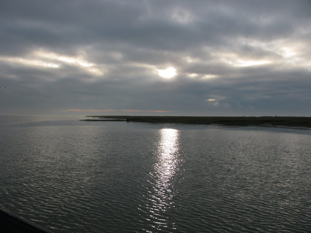
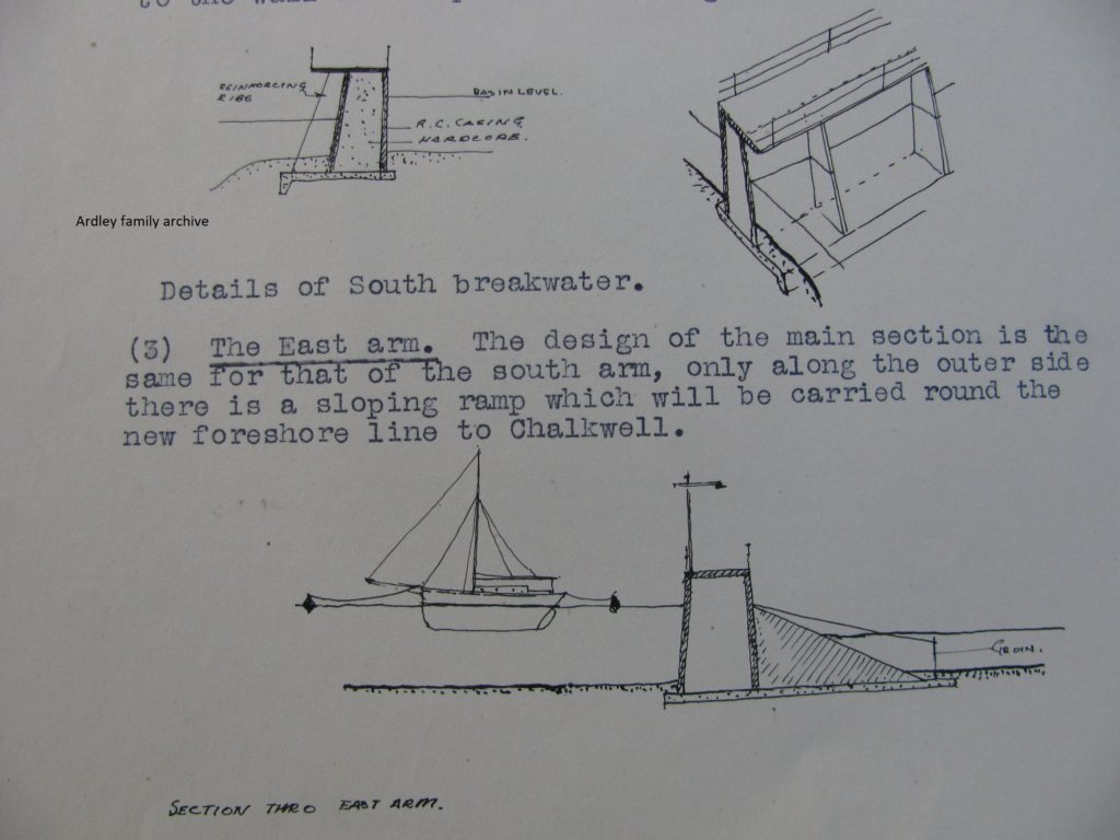
The thesis was a design proposal for a marina at the eastern end of Two Tree Island, incorporating the old channel (now silted) of the Ray up to the Two Tree Island Hard.
I found that an entrance lock was planned, facing east, leading into the Ray. The location would have been adjacent to the current position of Smallgains Creek, but of this, I shall add detail as I go…
For some years I had had my father’s rolls of old charts. One was marked up with an area of future development along the Leigh-on-Sea shore and showed how it had been a proposal to incorporate a chunk of South Benfleet and Hadleigh into a greater ‘Southend Conurbation’ – yikes!
In actual fact, ‘Southend’ own two chunks of woodland in Hadleigh – Hadleigh Great Wood and a neighbouring copse – a ‘present’ from a one time Southend mayor who lived at Solby’s House in Hadleigh.
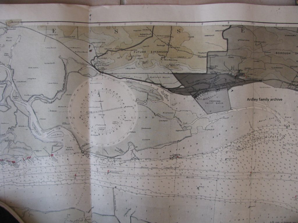
Interestingly, much of the very same area is currently being proposed as an inclusion into a new Southend West Parliamentary Constituency in part of a National realignment of boundaries, to reduce seats and rebalance constituent numbers. Less of that, but as I say, interesting…
The chart is a fascinating look back at the past. It shows the long tail of saltings running east from Canvey Island. This chart is similar to a chart from around c1850, I have. Yet, since then, the saltings at the island’s eastern end have rapidly eroded. I was measuring this denudation over a number of years a decade ago and found that around two to five metres were going each year.
That arm of saltings was stated to be a natural protection from prevailing south-westerlies. I think my father would be surprised to see the extent of there loss since his early 20’s. A little east of the marsh point, a shallow swatch now runs across – see picture below – which Whimbrel is sailed through regularly. It has been a western crossing of the Ray Bank for vessels for years now.
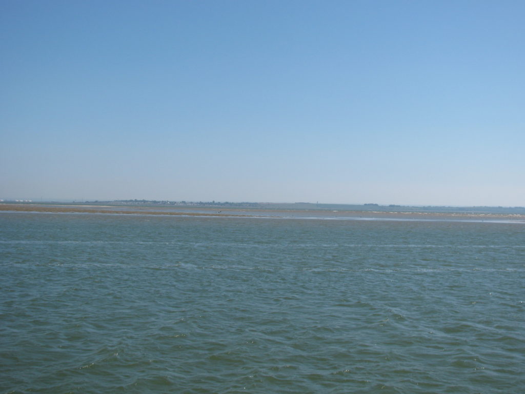
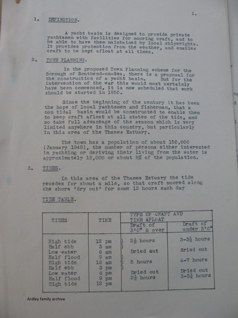
The thesis proposal was for a marina accessible at all states of the tide, I assume details of approach depths and so on. It had been something local yachtsmen (people) had aspired to for some decades. Historically, there had been a proposal for a marina in the bay at Chalkwell, some twenty years earlier during the late 1920s into the 1930s.
Two Tree Island was a very different place in those days – essentially a part tide flooded patch of marsh and agricultural grazing land. The border between Hadleigh and Leigh-on-Sea passed through its middle, as it still does. Leigh people like to think of the island as theirs, but it ain’t! The line was in essence the run of Mill Creek, which once flowed out of the valley on the north side of the high ground running up to Hadleigh Castle. The whole area was a ‘delta’ until solid reclamation on the mainland came with the railway in the 1840s.
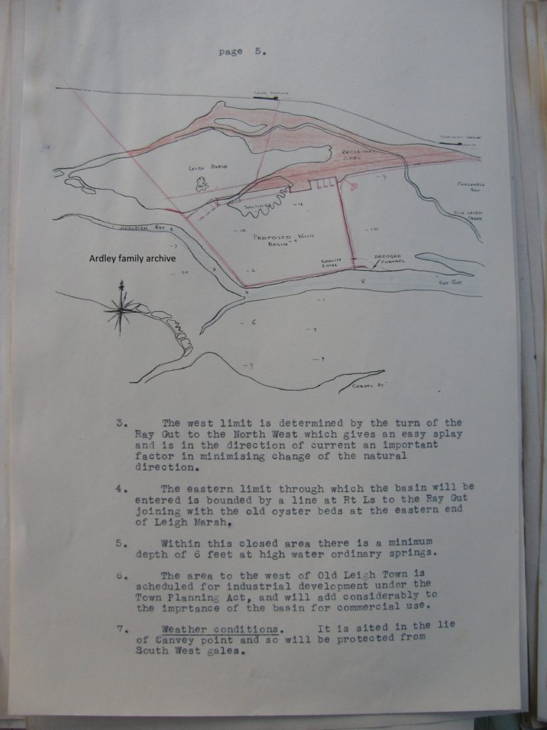
The thesis lays out the design background including local area plans that were current at the time…
The red area in plate above shows extent of land to be reclaimed! Yes, that was so, but also a large chunk of saltings and mud flats would have become the marina basin too.
One has to remember that the extent of the saltings running east from the eastern side of Two Tree Island was not as extensive as it is now. In fact for decades, barges had been extracting sand there.
Were Brent geese coming to the area in those days. I don’t know, but they surely would have done to a lesser extent. The ‘Thames’ was very polluted in that not so distant time.
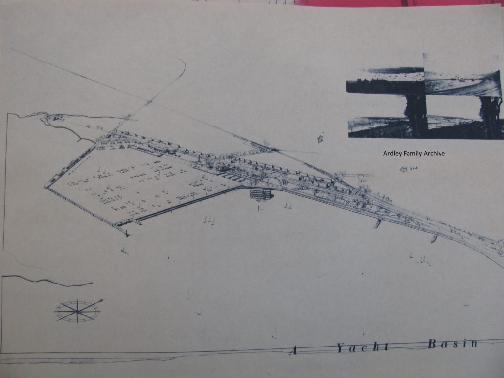
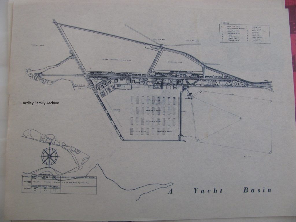
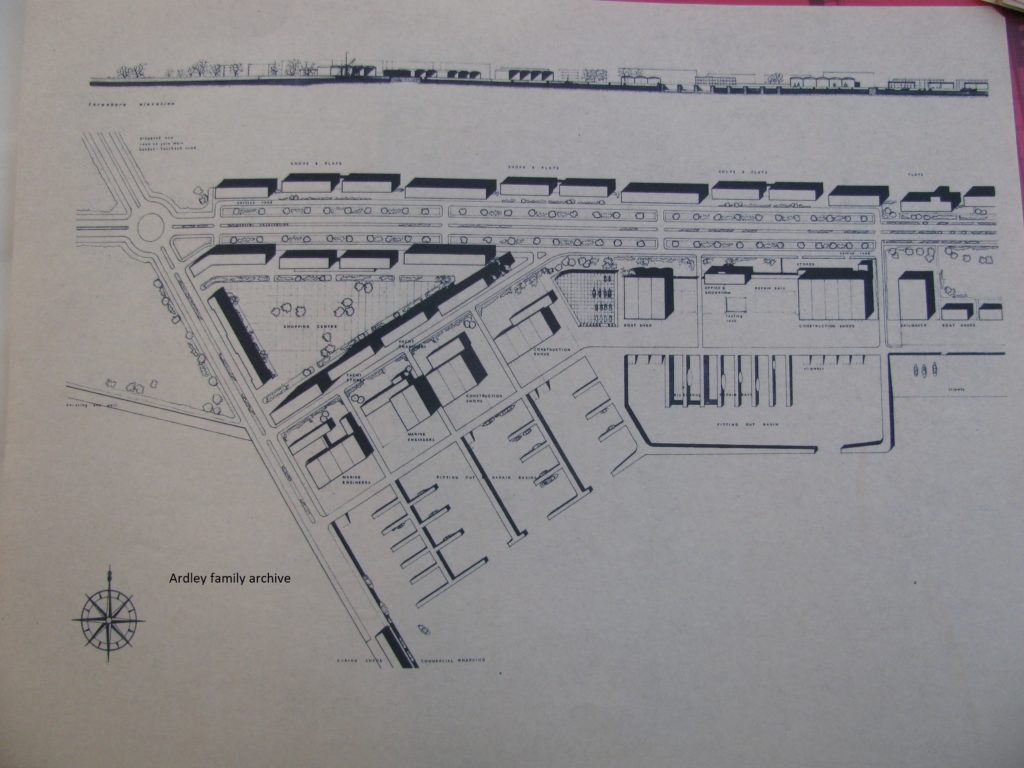
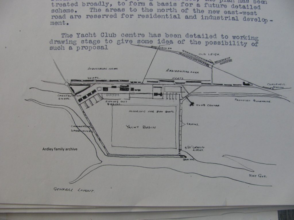
It can be seen from the outline drawing that the bulk of the marina basin was planned for the south side of the island, with yards, stores, businesses over what was the ‘saltings’ edge.
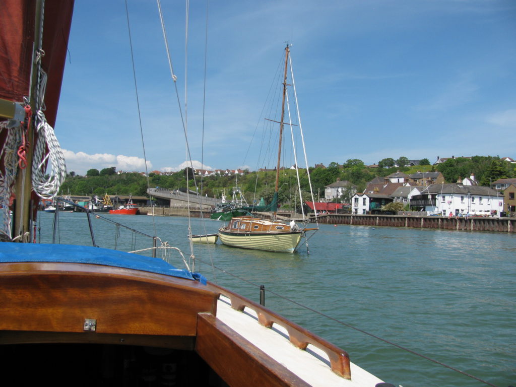
Below is a view across the silted and saltmarsh infested remnants of a once open mud flat area of Leigh Creek. The view looks down towards Chalkwell, and, if you know the area, the Essex Yacht Club Ship can be seen. Seventy years ago those saltings did not exist and it was a haven for small craft and houseboats.
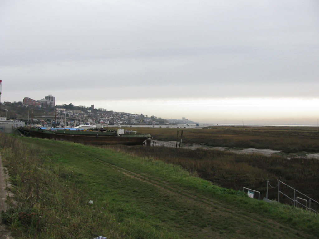
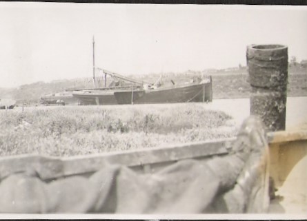
My parents moored their sailing barge May Flower in the area adjacent to the (new) Leigh-on-Sea station below the old hard across to Two Tree Island during 1951/2. The barge beyond was the ‘little’ Emma, owned by the Stubbs family.
Below is a layout of the marina development and replacement buildings to house displaced businesses. The northern boundary line is roughly the line of the current road leading onto Two Tree Island. The two truncated triangular shaped areas were marked ‘future development’ and sit where the refuse recycling centre, putting green and works to west of station and to the east the current Lower Thames Marine yard, layup facility, cockle sheds along to Crooked Billet public house.
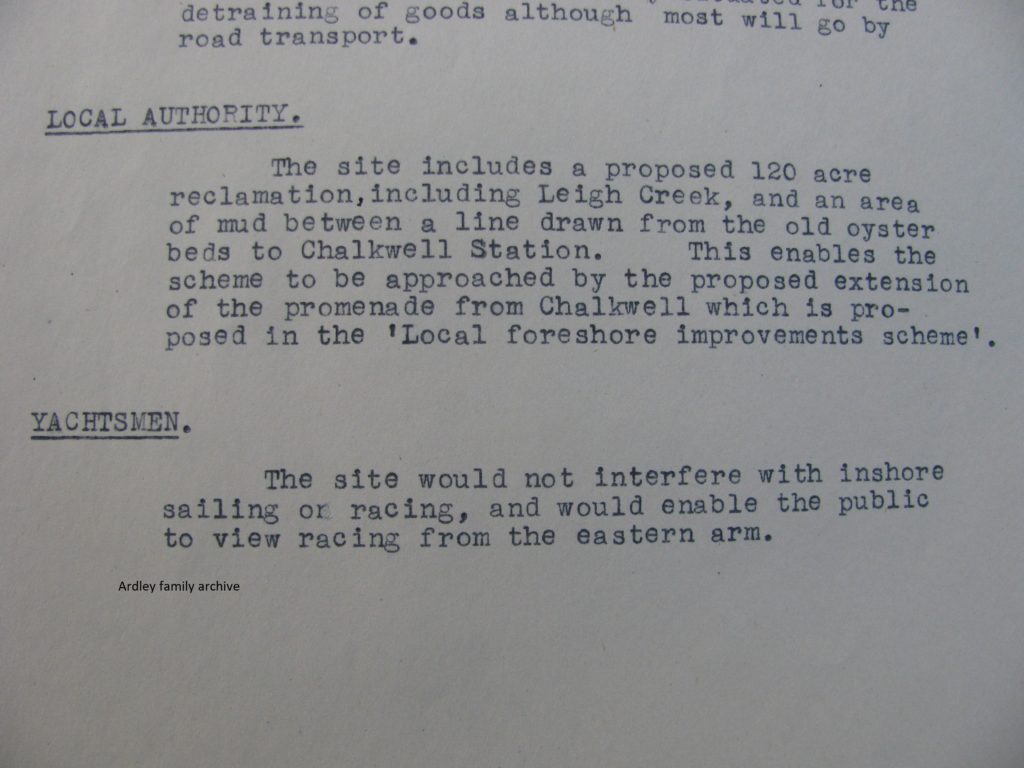
An esplanade was planned by Southend Corporation (as was) to run to seaward of the station at Chalkwell along past Leigh-on-Sea and incorporating a road. This was included in my father’s thesis. So, in essence he was building on the local authority plan…
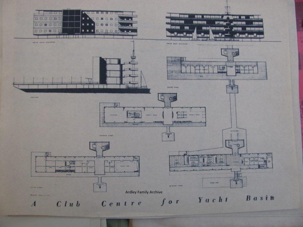
A futuristic club house building was proposed – this from its size was likely to house more than one club: several would have been displaced. The Essex and the Leigh were historically one, but split at the turn into the 1900s.
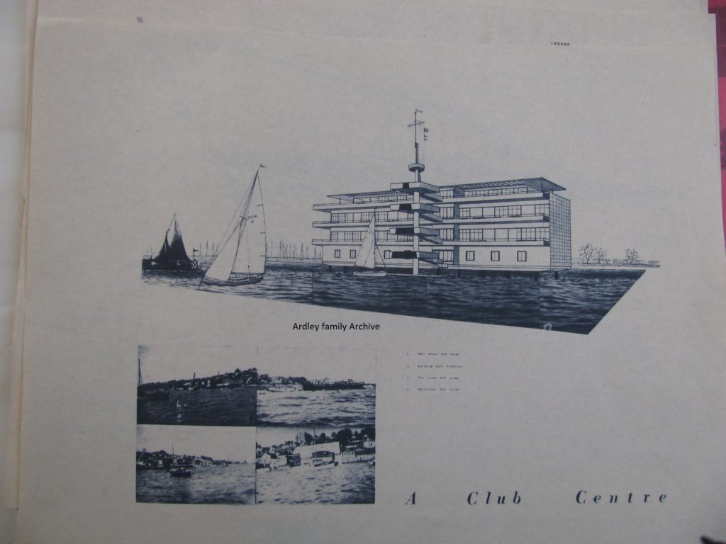
I would say that the design would have certainly put the area on the yachting map! It has overtones of the Art Deco building of the Royal Corinthian YC on the R. Crouch at Burnham.
Leigh-on-Sea at the time (1948) still had a fairly busy commercial waterfront. This was based around timber being shipped into the wharf where Mike’s Boatyard now sits, and the coal wharf which served the local gas works, essentially where the flyover comes over the C2C rail line.
Commercial wharfage was allowed for in the scheme, situated along the western wall of basin.
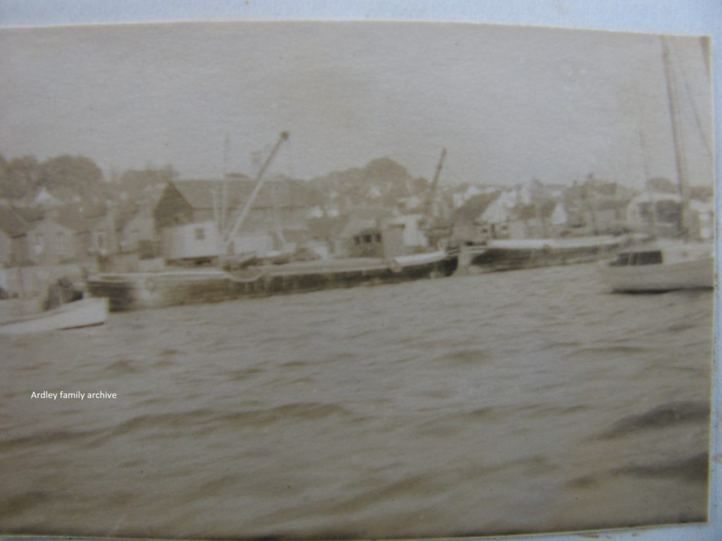
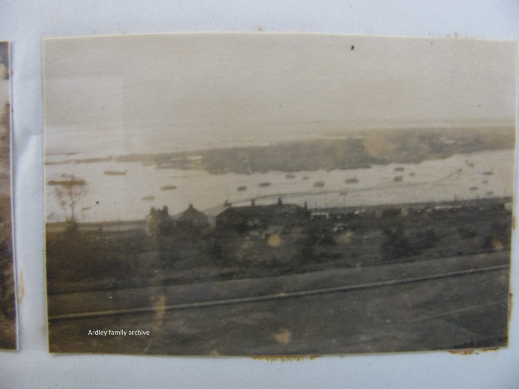
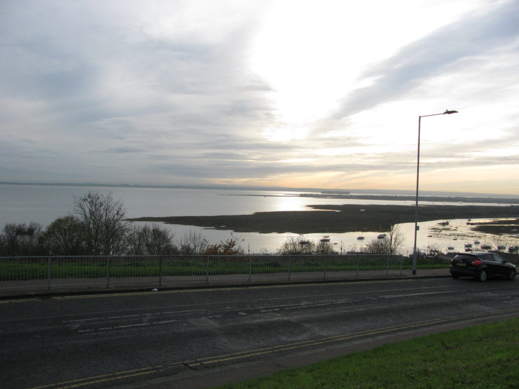
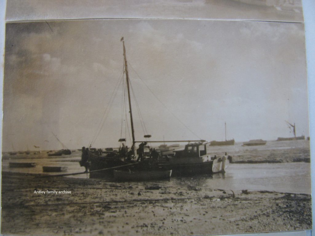
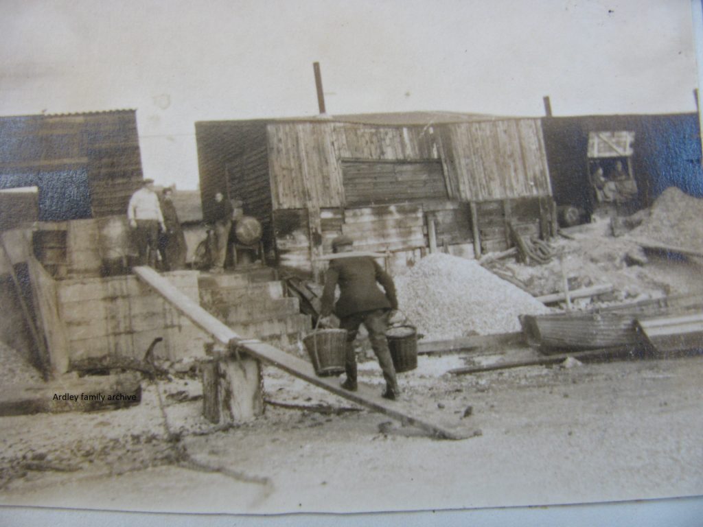
Amazingly, within my picture files, I have been able to mimic all the pictures taken by my father for use within his thesis. One, which I had to pop along to Leigh to get was a view looking over the eastern end of Two Tree Island. The hull of the spritsail barge Eva Annie is clearly visible to lhs of my father’s picture. Only her stem is essentially visible today.
I think my picture was taken a little to east of my father’s, however, the differences are clear with a growth of saltings where once there was mudflats covered by the tide suitable for sheltered moorings..
The building in the middle of the 1948 view is, I believe, the Billet PH.
With some use of imagination, the marina complex sits before your eyes…
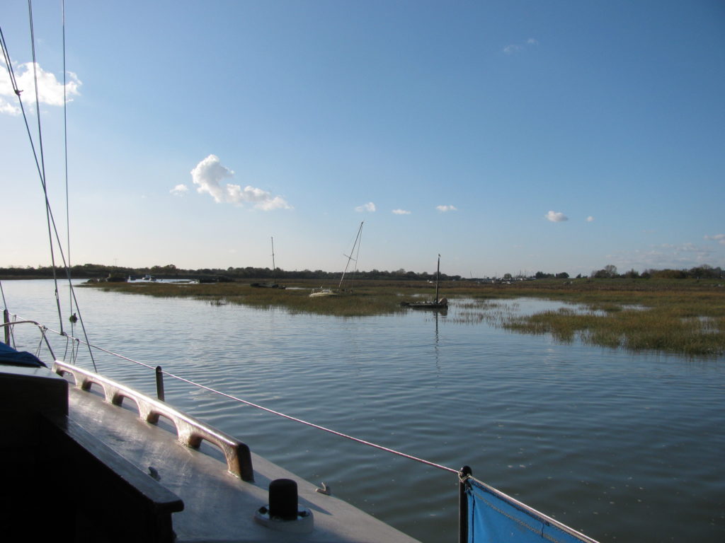
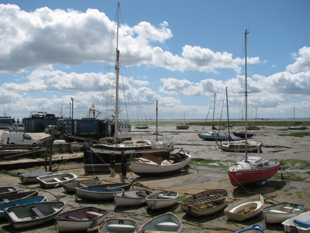
During this autumn, Christobel and I sailed Whimbrel up into Leigh Creek, taking the route across the flats then joining the withy marked rill up towards the moorings and yard of the Leigh Motor boat Club which resides directly below the relatively recent bridge across to Two Tree Island. The extent of saltings that have built up in seventy years is stark.
East of Bell Wharf, the eastern most of the town’s wharves, the current shore rubs hard up to the railway line with just a pathway (cinder path) barely a metre wide running along to Chalkwell where it becomes the esplanade running to Southend and beyond to Thorpe Bay & Shoebury.
The Essex Yacht Club has remained a ‘water based’ club aboard a converted club ship – currently an ex Royal Navy GRP Minehunter, the Wilton.
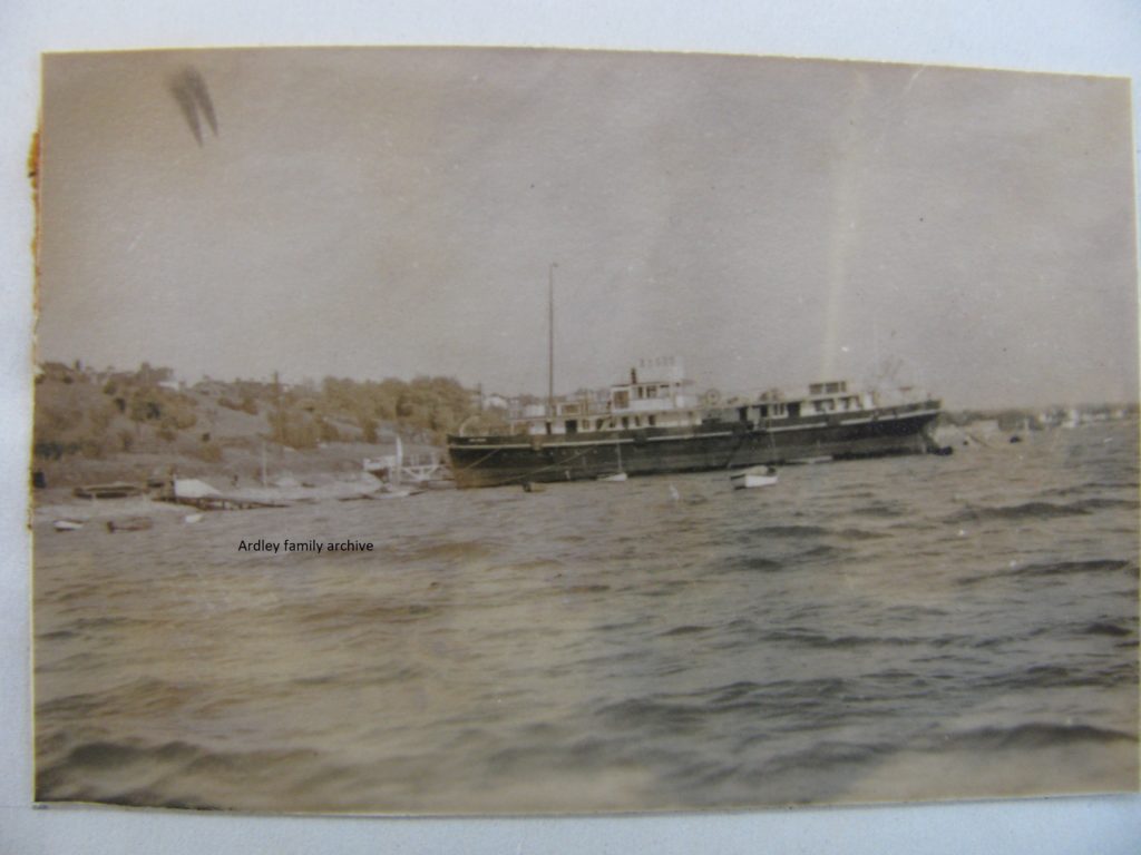
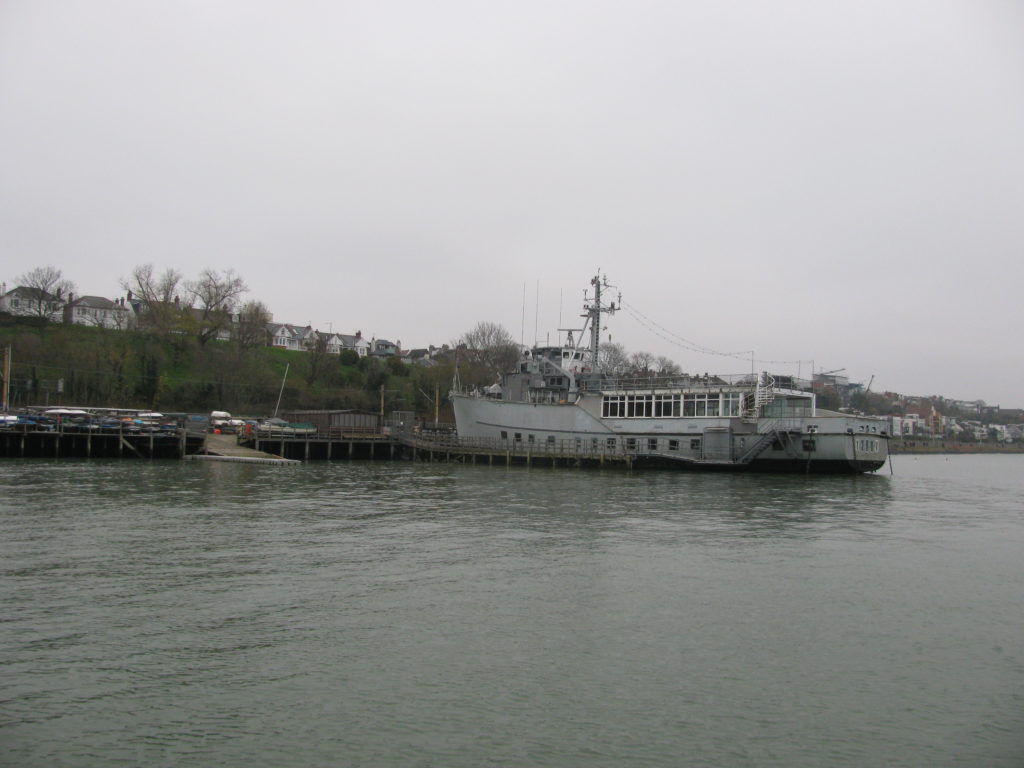
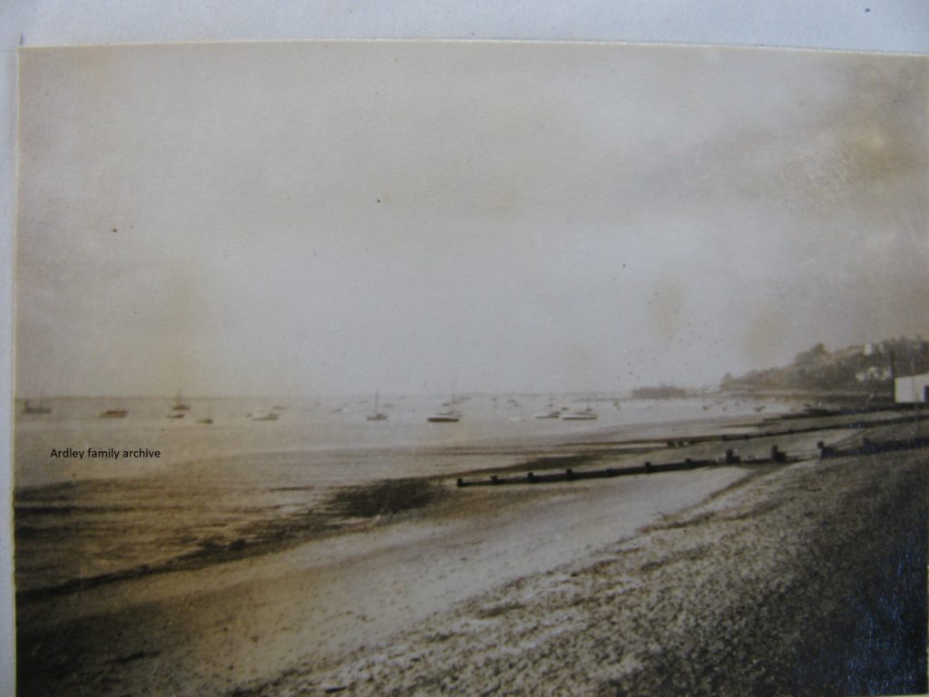
Below is a 1947 view looking west from close by Chalkwell Station. A line from the esplanade here to outside the distant Essex club ship to the current eastern tip of Two Tree Island was proposed to be housing and public spaces – essentially in line with the then local plan.
Below is a view across the old yard of Johnson & Jago, now Lower Thames Marina. Note cockle sheds along front beyond the shed front. Below it is a view recently taken a little east of the marina’s yard, looking past the Belton Way Little Boat Club. The strand that once sat in fron of the sheds has now been incorporated by the cockle community, with half-tide wharves out to the creek edge.
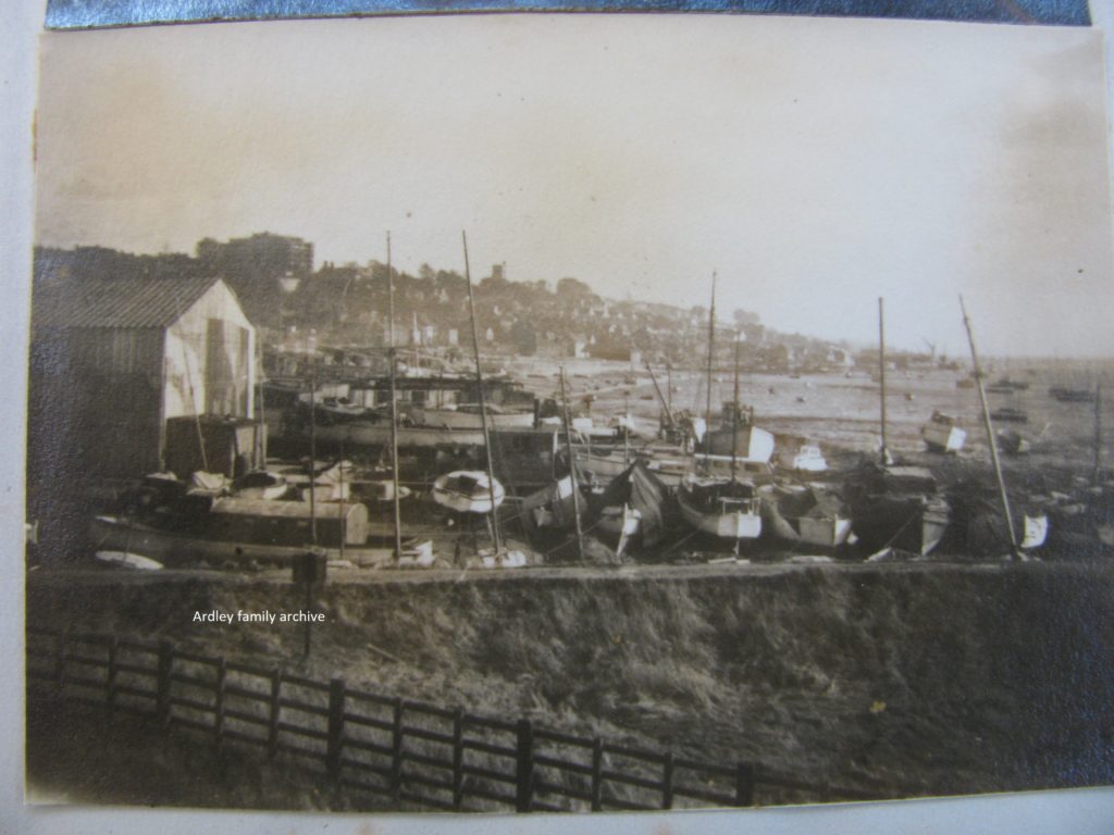
In the following picture, note too, the growth of saltings running east and towards the creek’s southern edge. Little banks of cord grass have crept down to where Leigh Creek turns away from shore, east of the old station (Leigh-on-Sea Sailing Club) and abuts the creek edge in many places.
It is one of the estuaries conundrums: although the level of the sea is rising and the land is sinking, locally, siltation and saltmarsh growth is rampant. Note: Essex and Kent have lost around 40% of their saltings in past fifty years.
Back at the end of World War Two, it was apparent that there were plans to extend the esplanade that runs from Shoebury past Southend to the eastern side of Chalkwell Station through past Leigh-on-Sea. A new southern road surface some years ago too, and died…
The waterfront area of Chalkwell was reclaimed from the sea many decades earlier and is an area at risk of flooding to this day. Sailing close to the shore, the view inland is not dissimilar to looking at Canvey Island.
The foreshore here is low and the tide arrives earlier than many other areas, hence the reasoning for Chalkwell Bay as a site for a marina earlier than my father’s thesis ideas
Even today, the idea of a marina in the Southend area is revived from time to time – generally centred on the Southend’s famous pleasure pier, however, most yachtsmen would want to know how berths would be protected from the forces due to weather and ship induced swells. Never mind the clear problems around access!
The finest idea in recent times came from a well known yachtsman (Royal Burnham YC) and businessman who wanted to build a marina and village on the western side of Canvey Island bordering Holehaven Creek – Mr Peter de Savary. However, his company’s plans were sunk by local opinion and a lack of local imagination, plus the discovery of the Carder Bee on some waste industrial land!
See: https://desavary.com
Currently, all yachting centres in the area are suffering increasingly severe problems from creek siltation. This is largely due to the misguided inning of much of the areas saltings over many decades back to before the age of the railway, which took away the largest area c 1840-50. The rapidity of useful creek water loss has increased following the blocking off of creeklets and their areas of saltings following the infamous 1953 east coast floods. This was admitted by the Coastal Agency at a River Thames Meeting held at the Island YC some years ago.
I personally fear this gradual demise of ‘useful water’. It is something that local yacht club’s are almost powerless to alter, other than tinkering around the edges.
The numbers of moorings laid off Leigh-on-Sea, even after the end of WW2, was far higher than it is now. Many craft currently moored west of the town’s eastern most wharf, Bell Wharf, do not float on neap tides or can move even before the tides pass the 5.0 m level (Southend). The situation will only become poorer as the years pass.
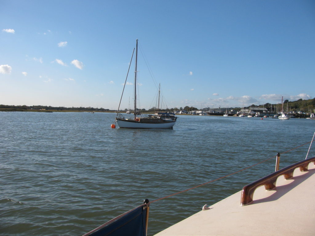
In the plate below, Whimbrel is sailing over the Leigh Flats, off The Peter Boat PH, with minimal clearance beneath her keel, yet it looks idyllic for sailing capers. I have recently been alerted by boating folk that the depth of water in the moorings of Lower Thames Marine are suffering from siltation – only constant dredging could alleviate this.
The local cockle community have taken over the Strand and it has become a wharfage that only floods on very high tides. Gone are the days when the boats listed over on the strand and were unloaded by men with baskets swinging on a yoke. Hard graft, for sure!
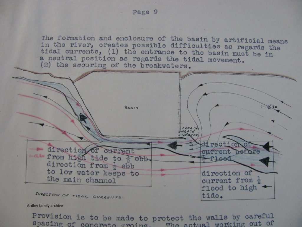
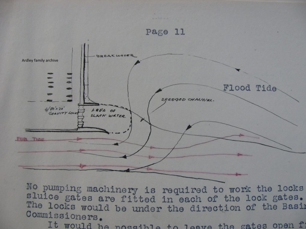
The thesis touched upon tidal streams that would most likely flow into and around the eastern wall of the idea. In the sketch below a tongue of sand is shown to the rhs. This feature is essentially still along that bank of the Ray, with a deep gut leading ‘west’ into the growing saltings on eastern end of Two Tree Island. There used to be a beacon along here until recent years.
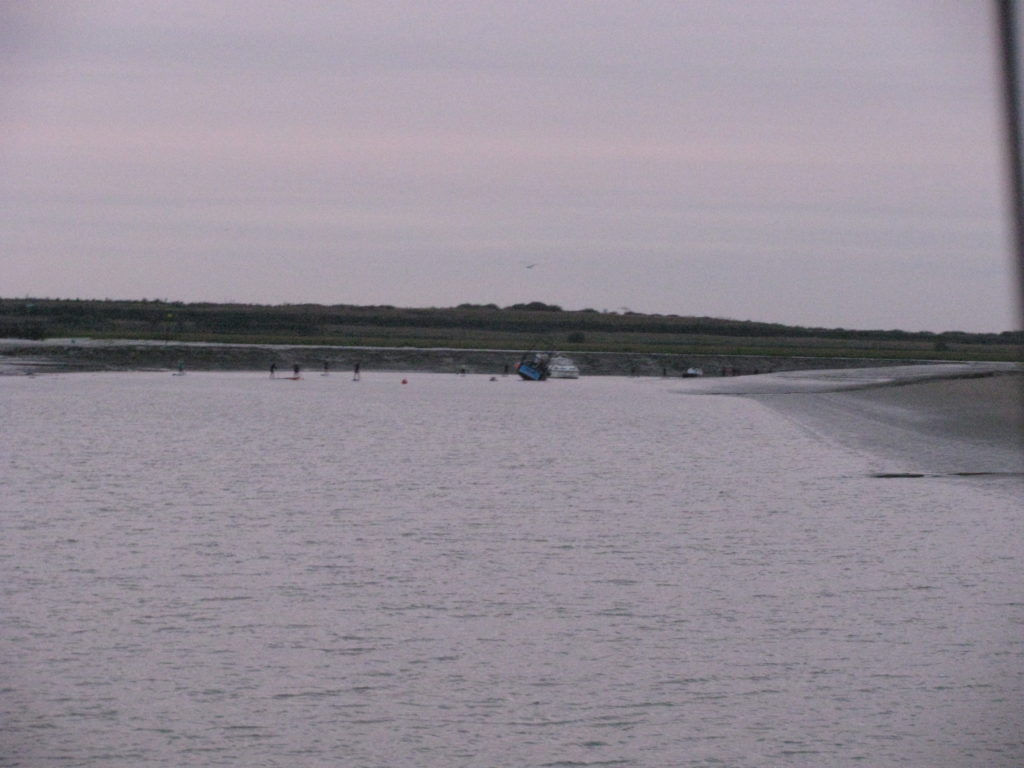
In the Ray Channel around here sits a horse (shallow patch) which dries during springs. The southern side of the Ray with a narrow channel is buoyed again after a period of years without. The buoys can be seen in plate below and the horse, which virtually blocks the Ray Channel. The picture was taken after a seriously low tide level. My Whimbrel just crept through after I’d sailed up to just below and grounding in the ‘middle’ of what was normally sufficient water. The dark ‘blob’ in the picture’s middle area is a cockle boat which was on the bottom even that far east.
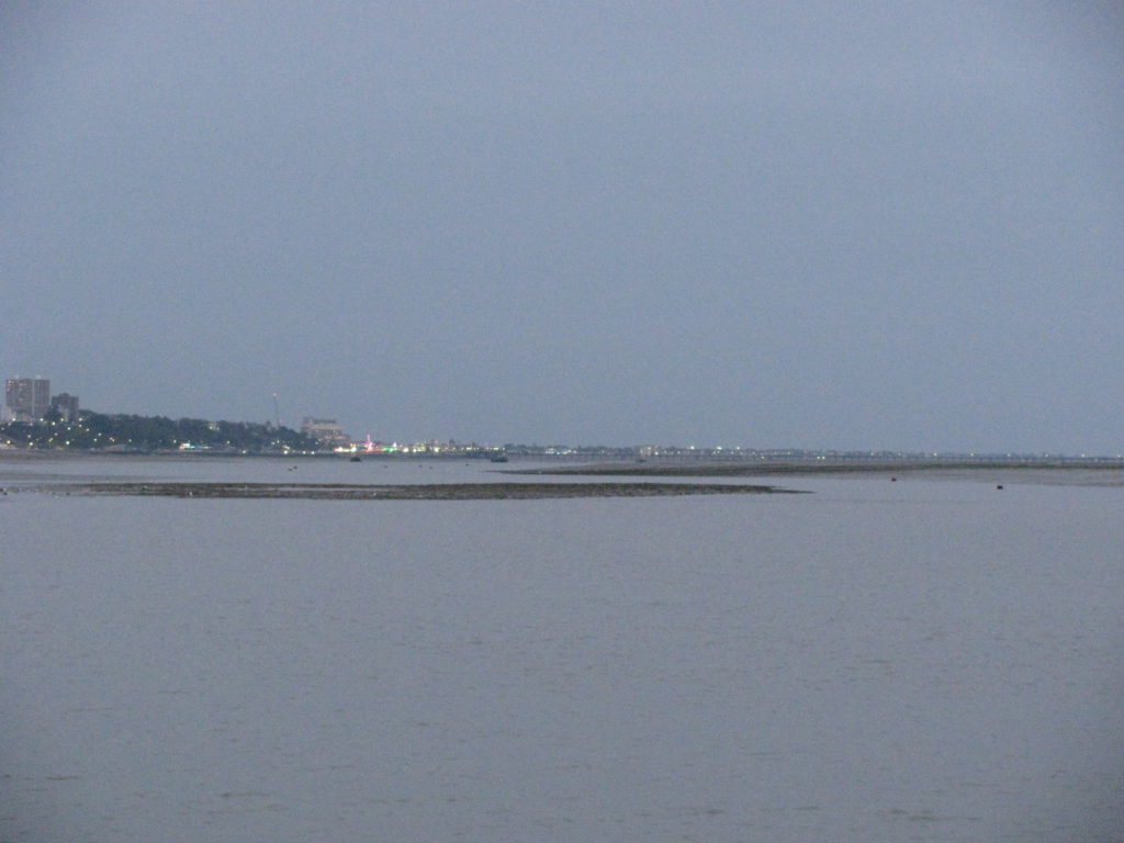
My father’s thesis stated that there was sufficient water for a 6′ (1.8 m) draft yacht to reach his proposed marina!
The marina’s entrance would have been a little east of the entrance to Smallgains Creek and I have incorporated a picture of Whimbrel in that area, which is the silted up northern ray channel around Bargander Sand (The big lump in the middle of the Upper Ray).
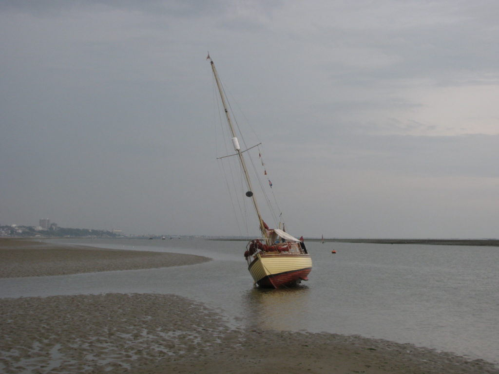
In the plate above, we had scrubbed off after returning before returning to our mooring during August. It is a perfect piece of firm clean sand. great for the mate to get in under the bottom…
Below is a close up of the thesis proposals. The entrance into Smallgains Creek now comes across the flats and joins Hadleigh Ray, as it is know this far in, a little to the east of sketched position.
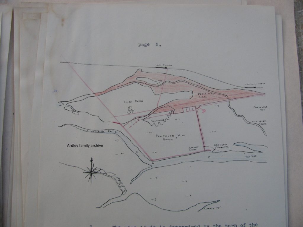
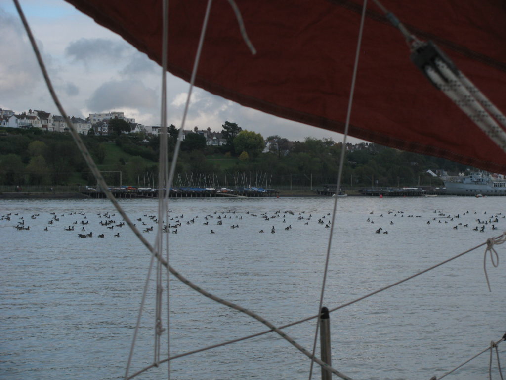
The extent of the thesis’s planned reclamation area isn’t the whole truth though: the marina basin would cover an expanse of sand/mud. The area now is rich in eel grass, a favoured delicacy of the Brent Geese which arrive every September.
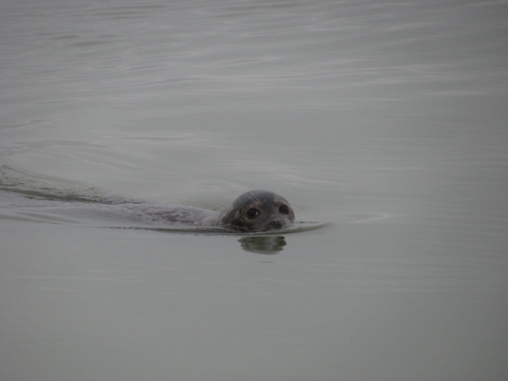
As is well known locally and far beyond, the area has become a magnet for wildlife. A seal colony spends their summer months in the Lower Ray off Chalkwell Bay. In winter, I frequently encounter seals whilst sailing. They even forage up into Smallgains Creek.
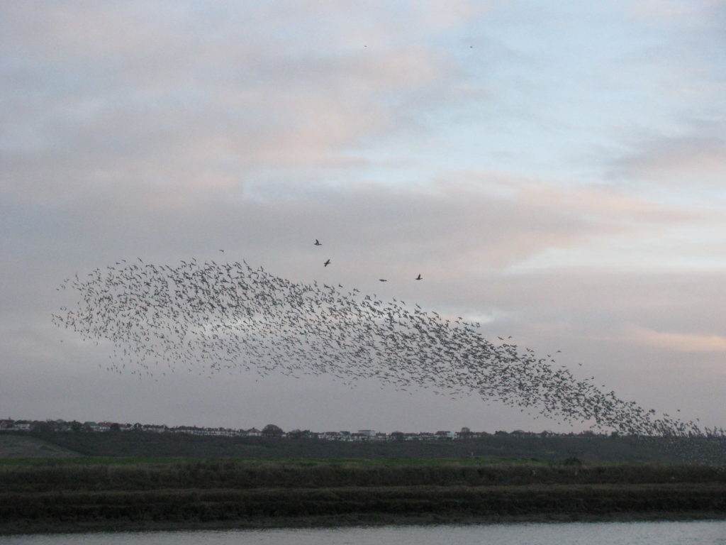
Wading birds of many species winter here too, feeding on the rich foodstuffs found in the shallow rills and mud/sand flats. The saltings provide shelter and food too.
Mitigation was an unknown concept then and, not surprisingly, it isn’t given a thought.
Would such a project see the light of day today?
It is doubtful, even with the availability of mitigation. Upriver, the building of the new container port required huge areas of land to be given back to the sea west of the site and over on (reclaimed) land along the Cliffe shore, where seawalls have been broken.
I believe, that flooding of land to west of Leigh under Hadleigh Downs was and remains a logical project. It would require the raising of the rail line, not insurmountable and the creation of islands within: the land has shrunk and immediately west of Leigh-on-Sea station the fields sit metres below the outer saltings. The sea wall could be broken and bridged to allow people to appreciate at a distance the recreated landscape. Wallasea Island’s return to the sea is working and provides a larger scale version of much needed satellite areas.
Some of the mud could come from locally used creeks…
The other question is whether a marina would be wanted by the local yachting community, who, like myself, enjoy the ‘tranquil’ ways of our marshland moorings?
All yachting folk know of many marinas: we all like a hot shower when cruising. We all like to just wander ashore and enjoy the ability to potter into a local waterfront hostelry for an inviting evening. There are so many positives…
What is certain is the future is becoming more and more difficult for deeper draft yachts in this Lower Thames idyll. The mud and salting growth along a half mile stretch of Benfleet Creek from below the barrier has been amazing to watch over the past twenty years.
Smallgains Creek is rapidly becoming a ‘gut’ with marsh moorings protected by a rapidly wasting island tail. Alluvial deposits creep ever more round the diminishing saltings. Will they eventually block Smallgains Creek?
What would have been the legacy. I think we all know the answer!
